New tool to drive development of smart cities
Organisations and local authorities planning for the development of smart cities and autonomous vehicle usage can now use a new tool to get access to data insights on everything from seatbelt usage to potholes and parking issues.

The tool provides access to intelligent datasets covering smart city planning, improved productivity for businesses and safer communities
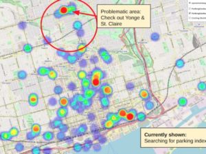
Developed by telematics giant Geotab, the data.geotab.com tool provides access to data from more than two billion data points collected daily from a network of over one million connected vehicles equipped with Geotab telematics devices.
The telematics technology can capture everything from vehicle GPS and accelerometer data, to speed, seatbelt usage, fuel consumption, engine diagnostics and more – data is then anonymised before being made available.
The data can play a key role in the development of automated solutions for issues such as congestion, parking and poor road conditions. It’s already being integrated by the City of Columbus into its Smart Columbus Operating System (SCOS) to help improve city operations in an economical and sustainable manner.
“Communities around the world will be able to leverage the intelligent data from data.geotab.com to better understand patterns in transportation, traffic, road conditions and more which will help prioritise safety measures among their communities,” said Mike Branch, vice president of data & analytics, Geotab. “Each dataset, including weather, urban infrastructure or location analytics, will advance driver and road safety measures, ultimately paving the way for safer, more sustainable and advanced smart city development.”

